blah blah blah
Pratt Mountain
Length: 5.2 miles out-and-backDifficulty (click for info): Moderate
Elevation Gain: 800 feet (+290 feet on return)
Rating (click for info): 6/10
Elevation: 1826'
Prominence: 171'
Driving Directions:
Trailhead and parking area are on Binney Hill Road in New Ipswich, NH. From Rt. 123/124, 1.6 miles west of the junction with Rt. 123A and 1.7 miles southeast of the northern split of 123 and 124, turn south onto North Road. At 0.7 miles, proceed straight through a four-way junction onto Poor Farm Hill Road. In 2.0 miles, it ends at Binney Hill Road. Turn right and drive 0.2 miles past the houses, to where the maintained road ends. Click here for a Google map.
About the Hike:
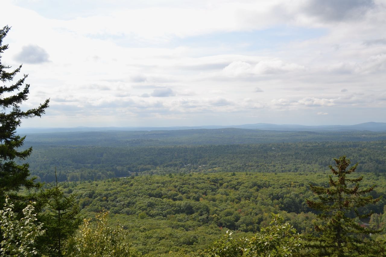
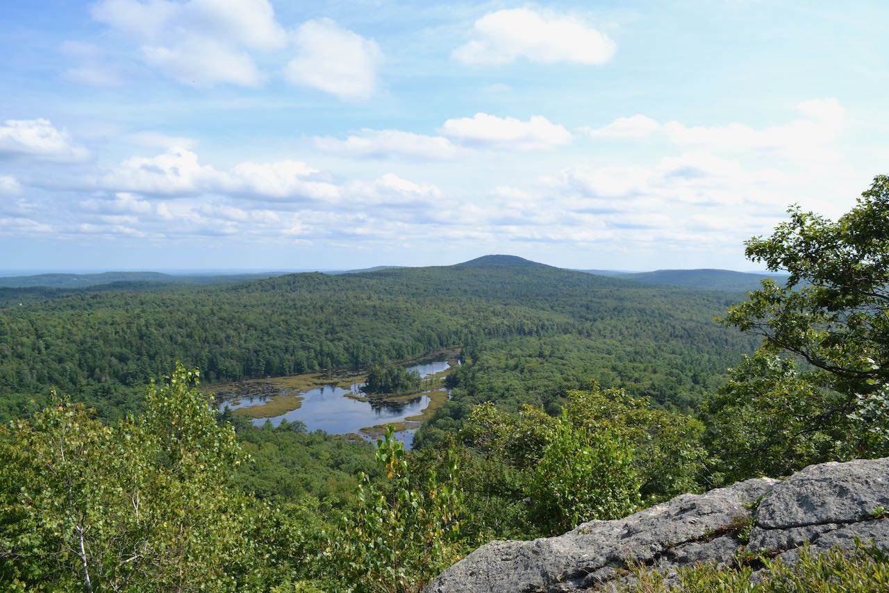
Pratt Mountain is the first summit encountered on the 22-mile Wapack Trail as it journeys northbound from the Massachusetts border. Like many other summits in the Wapack Range, the hillside features pleasing grassy ledges with many view openings. Practically, Pratt is more of an extended southern ridge of the higher New Ipswich Mountain, but it features all the best scenery spots, making it a more worthwhile destination. In between Pratt and New Ipswich is a long, flat shoulder with abundant ledges called Stony Top. A hike to Pratt must include a visit to this area, which offers excellent views to the west. The highlight of the hike may be passing by the marshy Binney Pond and then climbing up to a high ledge with a birds-eye view back over it.
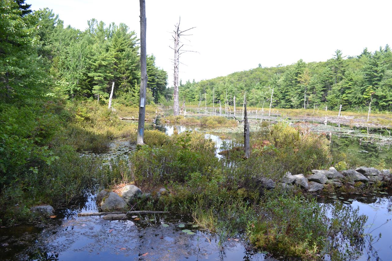
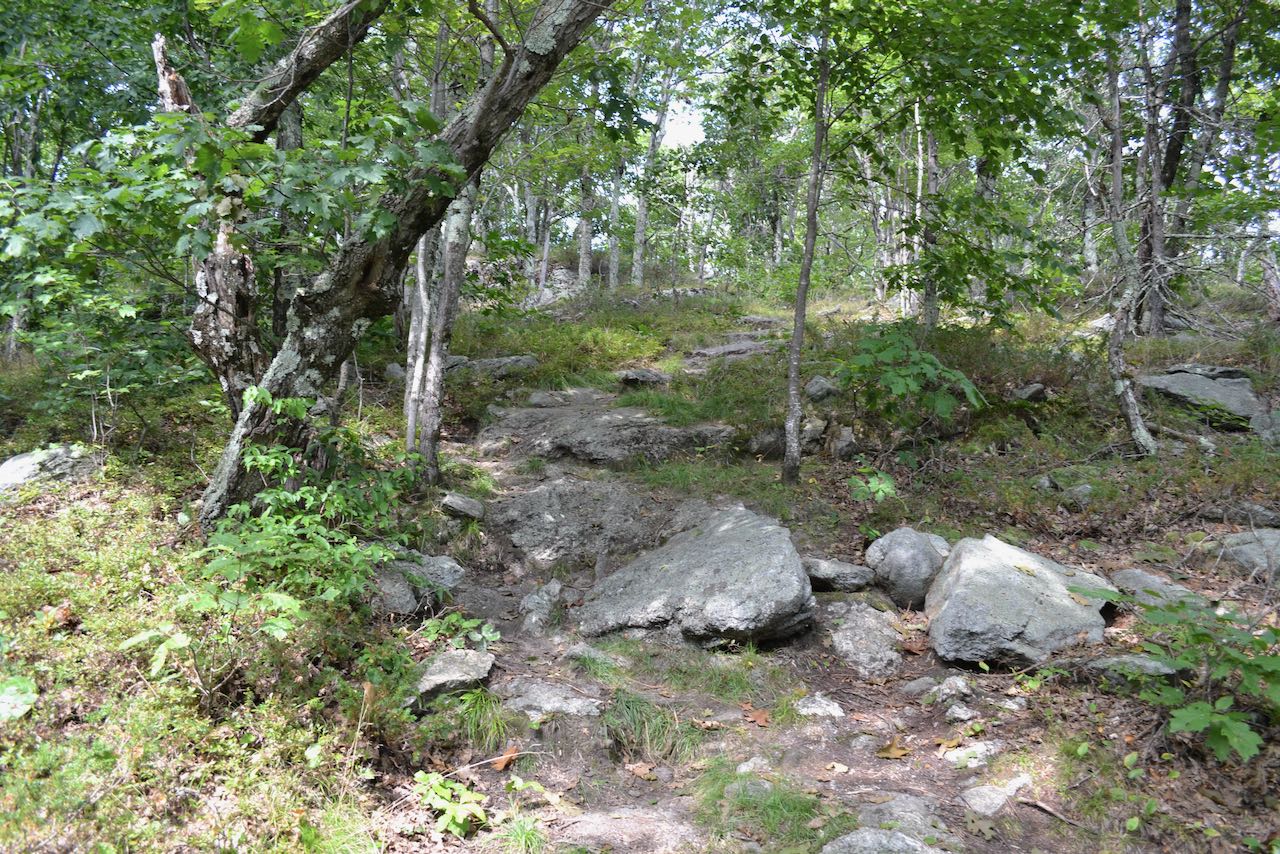
Continue on foot up the class 6 continuation of Binney Hill Road. The road climbs up a rather steep incline, and passes the entrance to a logging road on the left after 0.45 miles, where the Wapack Trail joins the road. The trademark yellow triangular blazes stay with the road for another quarter mile. Then, turn right off the road and follow the Wapack Trail through a row of boulders down a wide old woods road. It descends for 0.2 miles to cross the outlet brook from Binney Pond, crosses a boardwalk through the brushy edges of the marsh, and comes out to an opening looking out over the open water. Snags and lily pads populate the space in the pond, and an old stone wall sinks under the swamp. The trail cuts through the dense growth beside the shoreline, then passes through a more open, fern-filled area. It remains close to the marsh for about a quarter mile before straying away to climb up the hill. It rises a bit, while still keeping the water in sight through the trees. It then drops back down to cross a brook flowing into the marsh after another quarter mile. At this point, the trail climbs straight up the steep face of Pratt Mountain, amidst large boulders. About a third of the way up, the trail bends left and runs at an easier grade alongside a stone wall. The trail soon turns right and heads directly upslope again, entering into a scenic ledgy area with abundant grasses and blueberries. After a total climb of 0.3 miles, look for a side path on the right which leads out to a ledge with a fantastic view back toward Binney pond and out to Mt. Watatic in Massachusetts. Wachusett Mountain is also visible in the distance to the right.
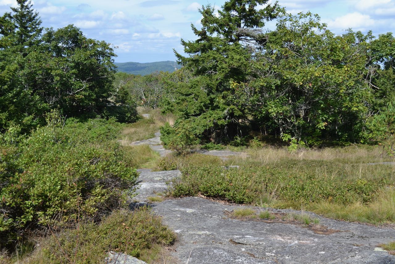
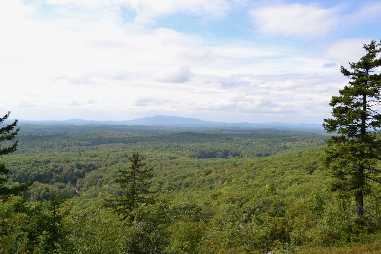
Another 0.2 miles up the main trail in and out of the ledges leads you to the summit of Pratt Mountain. Around the highpoint, you'll pass an opening with a view east, followed by a clearer view northwest toward Mt. Monadnock. The trail descends from the summit, then continues along the delightfully ledgy north ridge of the mountain for the next half mile, passing numerous outlooks in every direction. After 0.3 miles, the trail crosses a particularly nice open grassy area with a good view to the east. In another 0.2 miles, it culminates with the best views of the trek on the north summit of Pratt Mountain, called Stony Top. Along the open, rocky spine of this sub-peak, you enjoy fantastic views to the west. On clear days, some of the southern Green Mountains can be seen to the left of Mt. Monadnock. To the right is a chain of rolling hills, starting from Beech Hill and going past Osgood Hill, Skatutakee Mountain, and Bald Mountain. The long Mt. Sunapee ridge can be seen in the distance furthest to the right. Explore a bit further down the trail to see all the views.
Printable directions page